Tweedsmuir Provincial Park
Bulkley-Nechako E, British Columbia, Canada
 No relevant data Tue, Jan 27, 2026 at 8:21pm
BEACH INFO:
Tweedsmuir is a 981,000 hectare park, the largest provincal park in BC. For this mapping project, we will include this area in one overall view, even though the park itself contains both North and South provincial protected areas, many lakes, and many streams and rivers.
The park is near Williams Lake and Bella Coola; to get there, you may book a flight on Wilderness Airlines from Vancouver.
The park was named for the 15th Governer General of Canada, John Buchan, Baron Tweedsmuir, who had traveled the area extensively. According to BC Adventure, he stated in a book, "I have now travelled over most of Canada and have seen many wonderful things, but I have seen nothing more beautiful and more wonderful than the great park which British Columbia has done me the honor to call by my name."
The South Tweedsmuir Provincal area has a few precautions, including in January 2011, when flooding closed some facilities, and winter damage to some foot bridges on hiking trails in the Turner Lake Canoe Chain. Trails in this park are not regularly maintained, and strong caution is advised, especially during windy periods and after heavy snow and ice. Watch for fallen trees and road wash-outs. The government of BC notes that the Atnarko River can be extremely dangerous due to debris and fluctuating water. Only those with comprehensive knowledge of the river should even consider planning to trek it. At times, floods and winter damage may close boat launches, so be on the lookout. The south area consists of four ecological zones: apline tundra, Engelmann spruce/sub-alpine fir, sub-boreal spruce, and western hemlock.
The North area is considered a wilderness area, and visitors are warned to come equipped and self-efficient, as no supplies are around. Hunters must hunt only with licences, game tags, and knowledge of BC hunting laws (hunting is allowed only in the fall). Backcountry fees, such as to Eutsuk Lake and other areas, are in effect. The ecological zones in the north area are apline tundra and sub-boreal spruce.
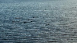
This area has been used for thousands of years by the Nuxalk (Bella Coola) people of the coast and the Tsihquot'in people of the interior, who all have relied on the salmon in the rivers. Angling is one of the most popular draws of the park. The nearby rivers have steelhead, truot, coho, and chinook. The Dean River is well-known for fly-fishing. The lakes have dolly varden, cutthroat, rainbow trout, and whitefish.
The parks also boast a canoe chain, including the Turner Lake chain, a 19 km route through seven lakes. The canoes can be rented at Turner Lake, or airlifted in. Take note of Hunlen Falls, 260m, one of BC's highest waterfalls.
The description above was copied from or heavily based on Swim Guide, with permission.
More Information
- Swim Guide - Weather and water quality for Tweedsmuir Provincial Park and 8,000 other beaches.