Sandy Beach
Bowen Island, British Columbia, Canada
 Passed tests Mon, Sep 9, 2024 at 12:47pm
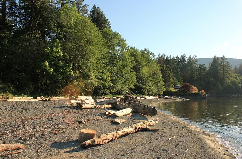
Sandy Beach is located on the South side of Mannion Bay, just north of the ferry terminal at Snug Cove. It's a popular spot for swimmers. There are picnic tables & washrooms.
FIRST NATIONS PLACENAME:
The name for Bowen Island in the Squamish language is Nexwlélexwm meaning “fast drumming ground". It was named this because deer were so abundant on Bowen Island, and the name reflected the sound their hooves would make when running. On Nexwlélexwm, the Squamish established a tiny village called Qole’laqom and here they hunted, fished or stopped over during long voyages up and down the coast.
Watch this video to learn how to say Nexwlélexwm - https://youtu.be/jWOpr6wtaUI
FIRST NATIONS HISTORY:
Bowen Island, Nexwlélexwm, is part of the ancestral and unceded territory of the Squamish Nation.
The island was not used as a permanent settlement ground. It was mainly used instead as a stopping ground on long journeys up and down the coast. The island also provided food and sustenance such as deer, salmon, and smelts herring, and therefore it also easily became a seasonal hunting ground.
First Nations Information From:
https://howesound.wordpress.com/2020/07/14/bowen-island-nexwlelexwm/
https://bowenislandmuseum.ca/first-nations-on-bowen/
https://www.bowenheritage.org/a-short-history-of-bowen-island.html
The description above was copied from or heavily based on Swim Guide, with permission.
More Information
- Swim Guide - Weather and water quality for Sandy Beach and 8,000 other beaches.