Pescadero Creek
Pescadero, California, United States
 FAIL 882mpn (single) Mon, Feb 10, 2025
 Passed tests Wed, Sep 24, 2025 at 2:23pm
 10.3°C / 50.5°F (air) Thu, May 14, 2026 at 1:45am
 16.9 - 29km/h NNW 328° Thu, May 14, 2026 at 1:45am
 Mist Thu, May 14, 2026 at 1:45am
 0mm Thu, May 14, 2026 at 1:45am
 8km Thu, May 14, 2026 at 1:45am
 100% Thu, May 14, 2026 at 1:45am

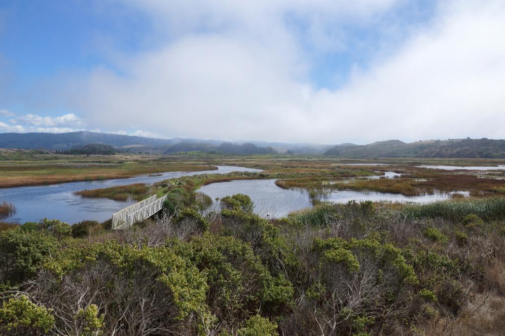
Photo by John Vonderlin
Stretching over 26 miles, Pescadero Creek is the longest stream in San Mateo County and is a critical body of water in the Pescadero watershed both historically and ecologically. Meaning “fishing place” in Spanish, Pescadero Creek has historically been an important fishing place for Indigenous peoples and early Spanish settlers. However, due to to intensive logging, watershed development and agricultural runoff over the 20th century, significant environmental degradation has occurred, and both the traditional steelhead trout and coho salmon populations have been nearly decimated as a result.
Ecological monitoring and restoration initiatives over the past several decades have made gains in preserving this crucial stream. The Pescadero Marsh Natural Preserve, located across the highway from the creek, is home to a diverse range of wildlife and is a popular destination among bird watchers. The mouth of Pescadero Creek is located within Pescadero State Beach and is serviced by the Central Pescadero State Beach Parking lot. Restrooms are available off the parking lot. Dogs and fires are prohibited.
The description above was copied from or heavily based on Swim Guide, with permission.
More Information
- Swim Guide - Weather and water quality for Pescadero Creek and 8,000 other beaches.