Nankin Boat Ramp
Valdosta, Georgia, United States
 No relevant data Fri, Feb 6, 2026 at 12:20am
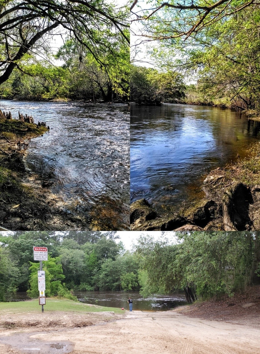
Good put-in for an 8.9-mile paddle downstream past springs and rapids to the GA-FL state line on the subtropical blackwater Withlacoochee River.
Concrete boat ramp in 1 acre park. PARKING: Free, PICNIC AREA.
You may see an otter; you will very likely see turtles and many fish.
In the summer you may see the swamp rosemallow that blooms only one day per bloom in June.
In the spring you will see red maple and wild azalea.
Buzzards will follow you, but don't worry: the alligators are more scared of you.
Don't miss McIntyre Spring, on the right, about halfway down.
It's one of only six second-magnitude springs in Georgia, and another is farther along: Arnold Springs.
Paddle times will vary from nope when the parking lot is flooded, very fast if the water is near the highest safe of 10.5' or 94' NAVD on the Quitman (US 84) gauge, or dragging the boat if it's below 1.8' or 85.25' NAVD.
Photos: top, Suzy Hall, John S. Quarterman.
http://wwals.net/maps/withlacoochee-river-water-trail/wrwt-map/wrwt-access/#Nankin-Boat-Ramp
The description above was copied from or heavily based on Swim Guide, with permission.
More Information
- Swim Guide - Weather and water quality for Nankin Boat Ramp and 8,000 other beaches.