Cates Park
North Vancouver, British Columbia, Canada
 Passed tests Thu, Aug 14, 2025 at 12:48pm
 -0.6°C / 30.9°F (air) Sun, Dec 4, 2022 at 8:30pm
 11.2 - 13km/h WNW 300° Sun, Dec 4, 2022 at 8:30pm
 Clear Sun, Dec 4, 2022 at 8:30pm
 0mm Sun, Dec 4, 2022 at 8:30pm
 10km Sun, Dec 4, 2022 at 8:30pm
 74% Sun, Dec 4, 2022 at 8:30pm

While we call this area Cates Park, the ancestral name for this land is Whey-Ah-Whichen which means ‘faces the wind’.
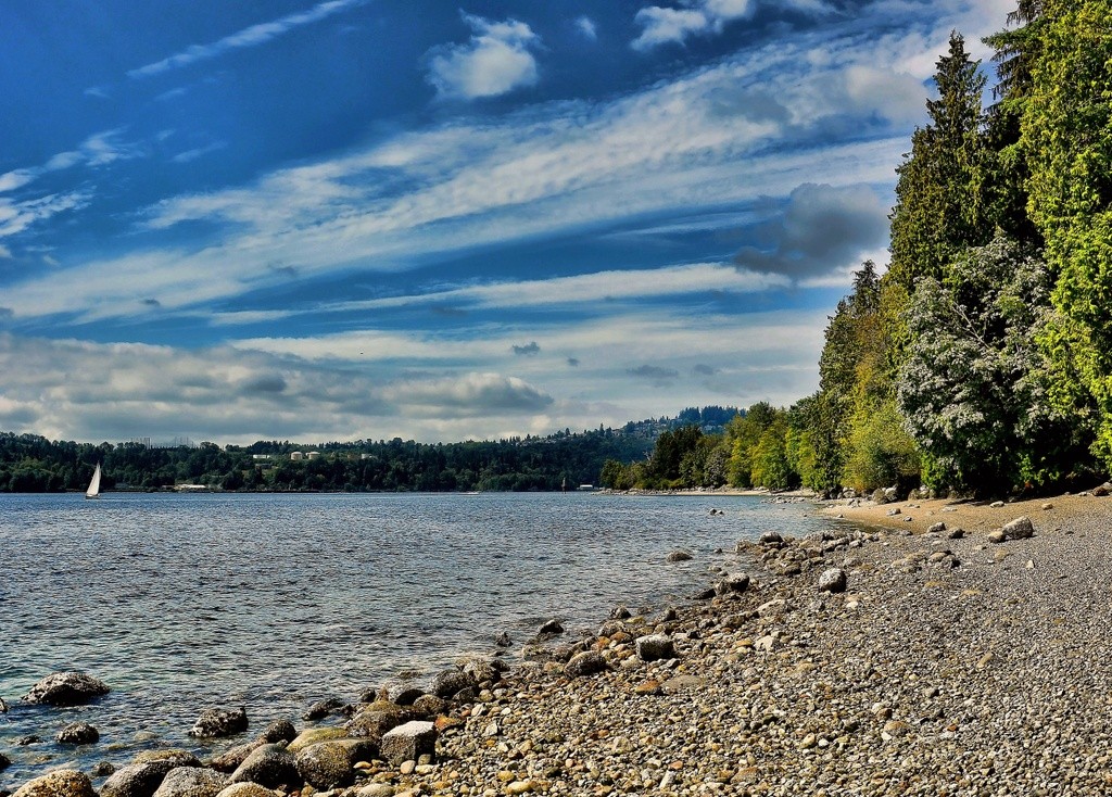
As North Vancouver District’s largest seaside park, Cates Park offers 6 km of waterfront trails that wind past sandy beaches and through a mixed forest of Douglas-fir and bigleaf maple. Viewpoints of tranquil Indian Arm to the north and busy Burrard Inlet to the south. tennis courts, trails, playgrounds, beaches, picnic shelter, a concession, and a display of native totems and a canoe offer year-round recreation with a cultural flavour.
This beach is dedicated to Sohan Sundher who enjoyed many family picnics at Cates Park and enjoyed taking the children to the beach to gather shells and play on the shoreline.
FIRST NATIONS PLACENAME:
Whey-ah-wichen
FIRST NATIONS HISTORY:
Whey-ah-wichen is an ancestral village site located on the inlet in North Vancouver. The h?n?q??min??m? (Hun’qumyi’num) placename means “facing both directions” and “facing the wind.”
Information from: https://twnation.ca/takaya-tours/
Photo: Valerie - Flickr
The description above was copied from or heavily based on Swim Guide, with permission.
More Information
- Swim Guide - Weather and water quality for Cates Park and 8,000 other beaches.