Bogue Falaya River at the Tammany Trace
Covington, Louisiana, United States
 Historically fails tests Tue, Mar 10, 2026 at 8:21pm
 25.1°C / 77.2°F (air) Sat, Jun 6, 2026 at 3:15am
 9 - 15.9km/h SE 137° Sat, Jun 6, 2026 at 3:15am
 Overcast Sat, Jun 6, 2026 at 3:15am
 0.1mm Sat, Jun 6, 2026 at 3:15am
 16km Sat, Jun 6, 2026 at 3:15am
 90% Sat, Jun 6, 2026 at 3:15am

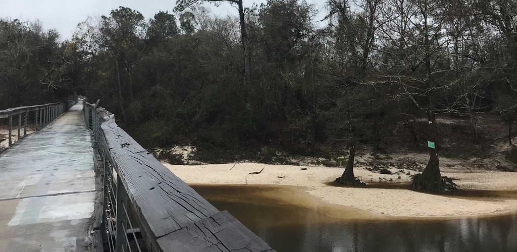
The Tammany Trace is a hike and bike trail that spans from downtown Covington, through Abita Springs, Mandeville and Lacombe and ends in Slidell. The Pontchartrain Conservancy (PC) collects a weekly sample from the bridge crossing at the Bogue Falaya. The crossing is seconds from the Covington Trailhead: an old-fashioned railroad station and includes a covered waiting platform, a clock tower, a bandstand, a sloped, grassy, shaded audience area, rest rooms, water fountains, visitor center, exhibit hall and small movie theater. For access to the water, head down to the Bogue Falaya Wayside Park, which has a boat launch, bathroom, and playground.
The description above was copied from or heavily based on Swim Guide, with permission.
Features
- Walking Trails
- Bike Paths
More Information
- Swim Guide - Weather and water quality for Bogue Falaya River at the Tammany Trace and 8,000 other beaches.